Public Transport Wayfinding
(Logan City)
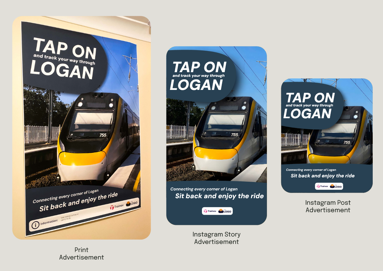
Logan City’s transit maps are currently daunting due to visual complexity, low contrast, and small text. Informed by commuter survey data, this project attempts to address these accessibility barriers through a high-contrast, schematic way finding system and integrated marketing campaign. By using glare-reducing colour schemes, bold typography, and clear hub markers, the design applies visual communication principles to help visually impaired commuters navigate independently. An integrated marketing campaign was also created to bring more awareness to the network, across both digital and print mediums.
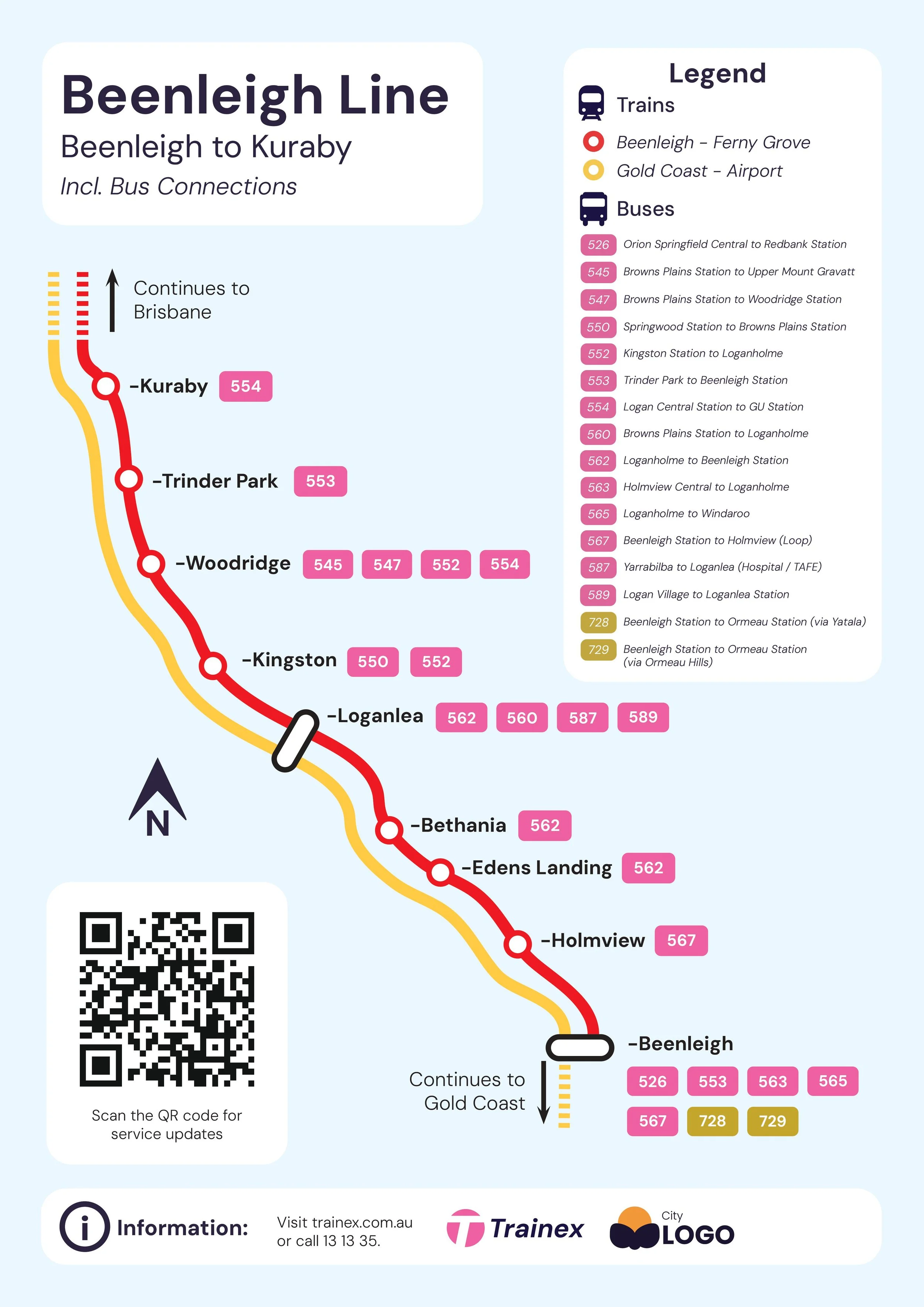
Train Map (Kuraby to Beenleigh w/ Buses)
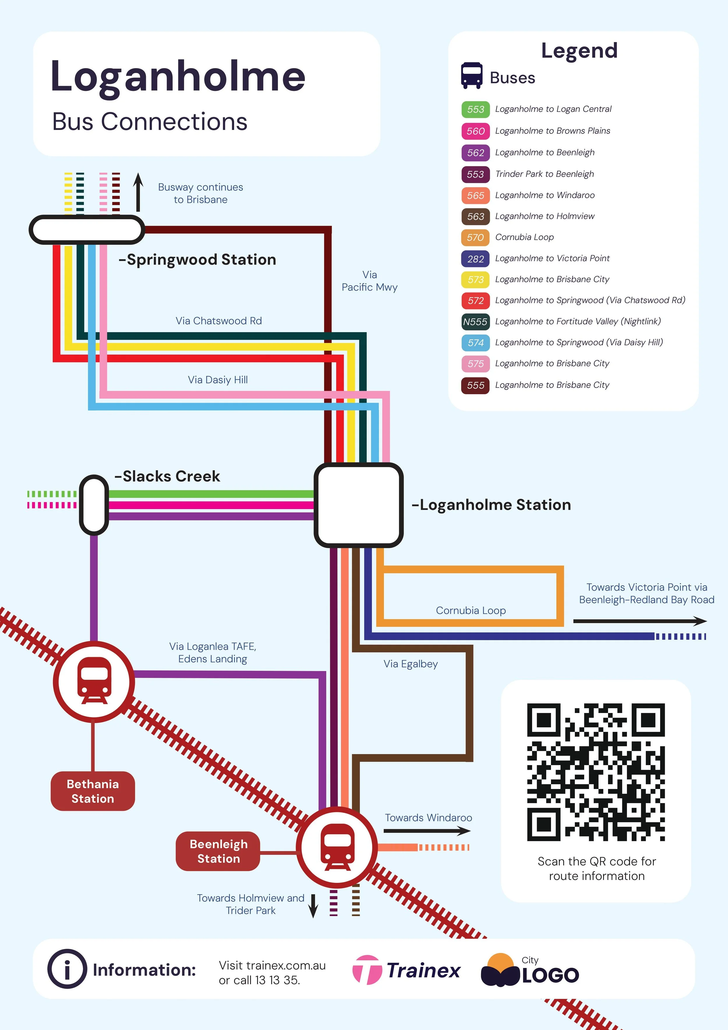
Bus Map (w/ Train Connections)